
I got bored with doing all my local rides and wanted to do something different. However, I haven’t really been training for any long rides so I was in somewhat of a quandary as to what to do. Finally, inspiration struck; I would ride over both Blewett Passes.
“When the highway was built across the mountains from Ellensburg to Wenatchee, it was given the name of Blewett Pass Highway, in recognition of the narrow dip in the hills that allowed the road to make its way through the rugged wall of mountains. The highway was narrow, with steep, sharp switchbacks, and driving was hazardous. Forty years ago, Highway 97 was rerouted from Blewett Pass to Swauk Pass. The new road was wider, straighter, and totally free of the pesky switchbacks that plagued the old road. Despite the Swauk Pass sign at the summit, people continued to refer to the road and the pass it crossed as Blewett. Finally, in the late 1990s, the highway department gave in to years of tradition and changed the name of Swauk Pass to Blewett Pass.” (Trails.com) The original Pass is now commonly referred to as ‘Old Blewett’ and the new simply as ‘Blewett.’
Tuesday morning I set out on my trek. I would be crossing Old Blewett first and returning over Blewett. Twelve miles from Cle Elum I stopped at the Liberty Café; 
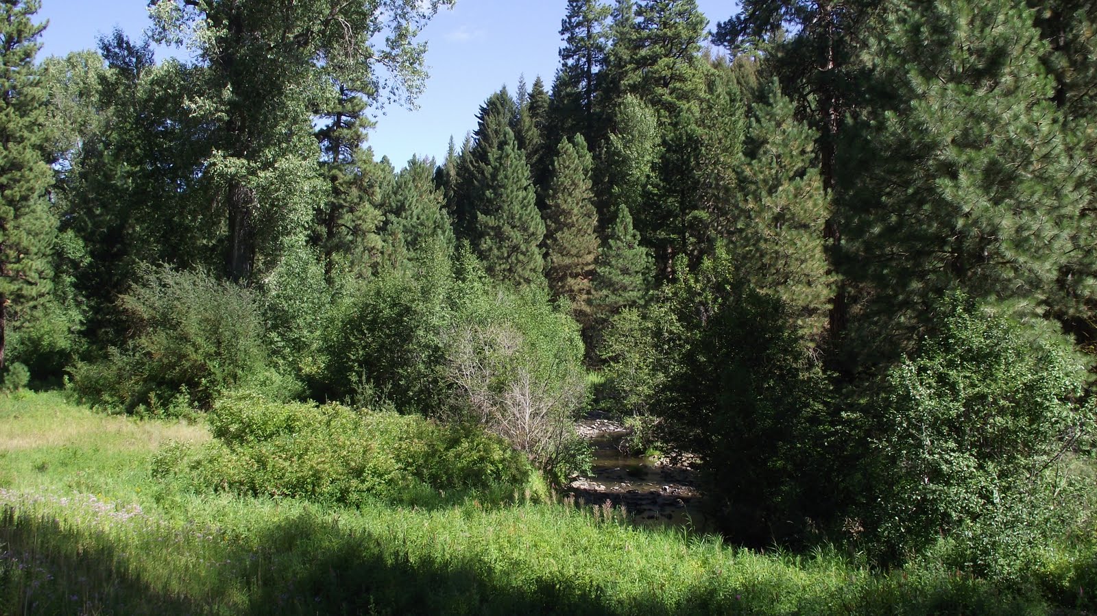
this place has the best pies in the area (except for those made by my wife) however, it was too early in the day and the trip to reward myself so I settled for a cup of home-made soup. I’ve ridden this section of road quite often and the scenery is usually very nice;
this year, for some reason there are a lot of fir trees dying. I found this throughout my trip and consequently, took very few pictures—it was too disheartening to see so many brown trees. A bright spot was the creek running alongside the highway
which I could also hear because there was very little traffic. Finally, about 8 miles from the Liberty Café, I came to the turn-off for the old highway;
Google Earth shows an elevation of 3044’ at this point. The road is not maintained and there were numerous rocks, potholes and hairpin curves throughout its length to the Pass. However, given my slow speed and the absence of traffic (one car) coping with these hazards was no problem. Four and a half miles later I crested the summit
(4069’.) That’s an average grade of 4.3 % although there were some sections of 2 – 3 % and a couple of stretches that were close to 10%. The five mile downhill run to the campground found the roadway fraught with the same hazards as on the way up;
however, the faster speed I was able to achieve made it slightly more challenging to avoid them.

this place has the best pies in the area (except for those made by my wife) however, it was too early in the day and the trip to reward myself so I settled for a cup of home-made soup. I’ve ridden this section of road quite often and the scenery is usually very nice;

this year, for some reason there are a lot of fir trees dying. I found this throughout my trip and consequently, took very few pictures—it was too disheartening to see so many brown trees. A bright spot was the creek running alongside the highway
which I could also hear because there was very little traffic. Finally, about 8 miles from the Liberty Café, I came to the turn-off for the old highway;

Google Earth shows an elevation of 3044’ at this point. The road is not maintained and there were numerous rocks, potholes and hairpin curves throughout its length to the Pass. However, given my slow speed and the absence of traffic (one car) coping with these hazards was no problem. Four and a half miles later I crested the summit

(4069’.) That’s an average grade of 4.3 % although there were some sections of 2 – 3 % and a couple of stretches that were close to 10%. The five mile downhill run to the campground found the roadway fraught with the same hazards as on the way up;

however, the faster speed I was able to achieve made it slightly more challenging to avoid them.
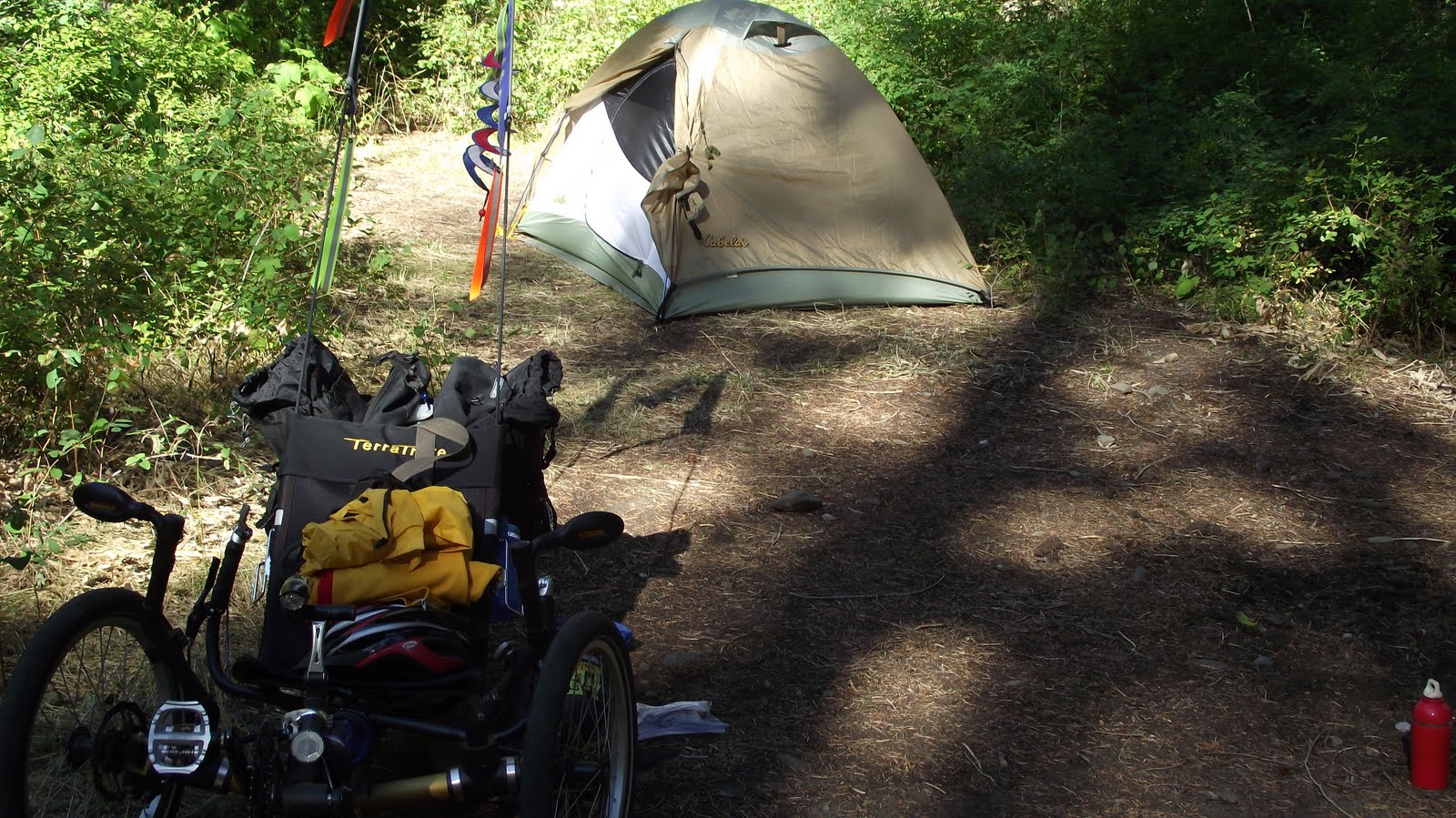
Arriving at my campsite, the first order of business was brewing a cup of tea.
This is a no-fee camping area and after setting up my tent,
I explored the creek that babbled twenty yards away.
This is an area of gold mining and there were numerous signs denoting a claim had been filed; consequently, I was a bit wary when I washed my cooking utensils lest someone would think I was jumping their claim.

This is a no-fee camping area and after setting up my tent,
I explored the creek that babbled twenty yards away.

This is an area of gold mining and there were numerous signs denoting a claim had been filed; consequently, I was a bit wary when I washed my cooking utensils lest someone would think I was jumping their claim.
The next morning I was thankful that I’d packed a flannel shirt—it was uncomfortably cool! However, after making breakfast, striking camp and pedaling a mile out of the canyon to Highway 97, the shirt was quickly relegated to a pannier. The elevation where I joined the highway is listed as 3126’; eight miles later I hit the pass.
Although that works out to an overall 2.3% grade, there were lengthy sections that were only 1 – 2% which resulted in about a 5 – 6% grade for the last 2 miles before the summit. The road is very well maintained with a 5 or 6 foot shoulder almost the entire way; there were a few short sections where that narrowed to 2 or 3 feet.

Although that works out to an overall 2.3% grade, there were lengthy sections that were only 1 – 2% which resulted in about a 5 – 6% grade for the last 2 miles before the summit. The road is very well maintained with a 5 or 6 foot shoulder almost the entire way; there were a few short sections where that narrowed to 2 or 3 feet.
From the top, it’s all downhill for about 13 miles to the Liberty Café where pie would be an appropriate reward. The remaining 12 miles back to Cle Elum would have been anti-climactic were it not for two factors: heat and a headwind. However, I persevered and arrived home totally spent and totally satisfied that I had conquered both Blewetts!
